1. Any properly referenced spatial data will have a spatial reference system (SRS).
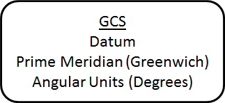
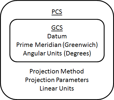
2. An SRS can be a Geographic Coordinate System (GCS) or a Projected Coordinate System (PCS).
3. A GCS contains a datum, prime meridian and angular units. We really only worry about the datum because the prime meridian is almost always Greenwich and the angular units are always degrees.
4. A PCS contains a GCS, because we need to know the datum, a projection method, optional projection parameters, and linear units.
5. Shapefiles will have their SRS in a ".prj" file. Other spatial data formats may have a ".prj" or they may put the SRS into the same file with the data (i.e. you have to load the data into a GIS app to see the SRS).
© Copyright 2018 HSU - All rights reserved.